
حلول هندسية ومساحية دقيقة
تدعم التنمية الوطنية
+
عامًا من الخبرة
+
مكتب هندسي
+
مشروع إنشائي
دقة هندسية… تدعم التنمية في كل مكان
من خلال دمج أحدث التقنيات مثل المسح الجوي، وتقنية LiDAR، والاستشعار عن بُعد، ونظم المعلومات الجغرافية GIS، نوفر بيانات هندسية دقيقة تساعد على اتخاذ قرارات مبنية على التحليل والدقة.
كما نمتلك خبرة واسعة في النمذجة ثلاثية الأبعاد (3D Modeling) وتحليل السحب النقطية (Point Cloud Analysis)، مما يجعلنا من الشركات الرائدة في تقنيات هندسة المساحة داخل المملكة.
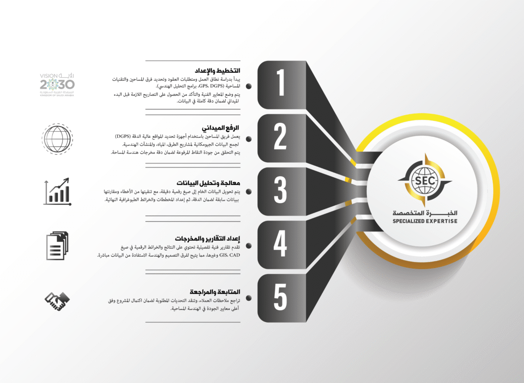
مراحل تنفيذ أعمالنا
نماذج من مشاريعنا
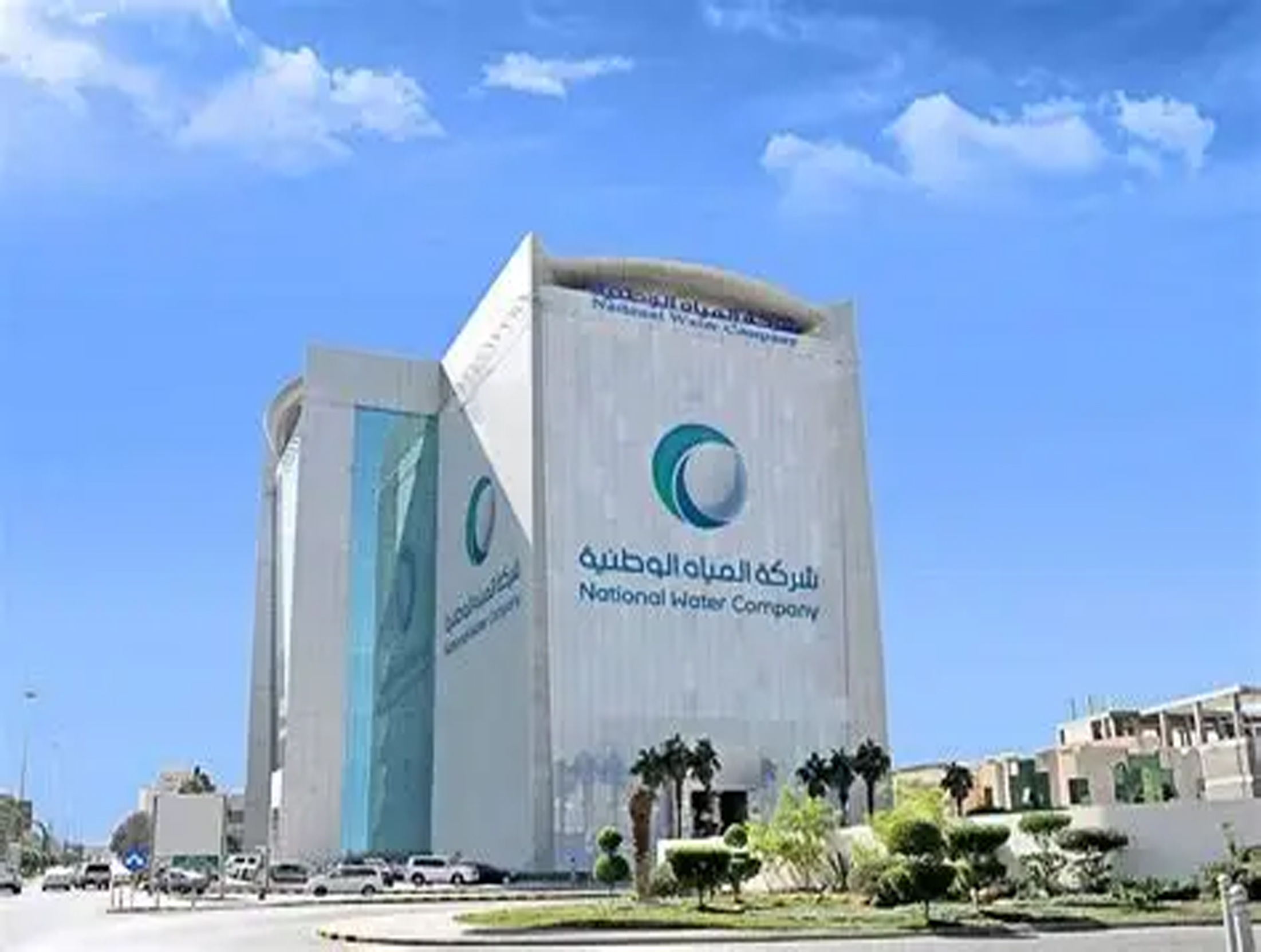
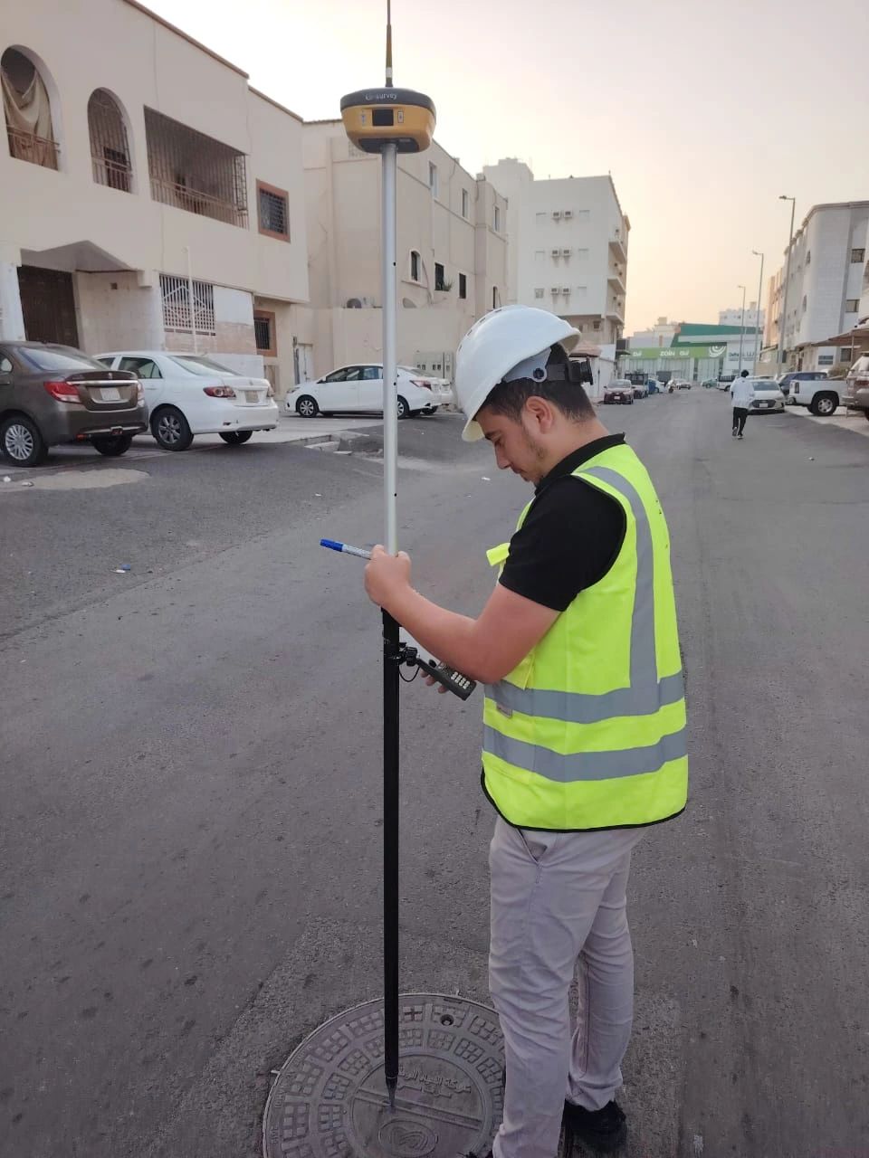
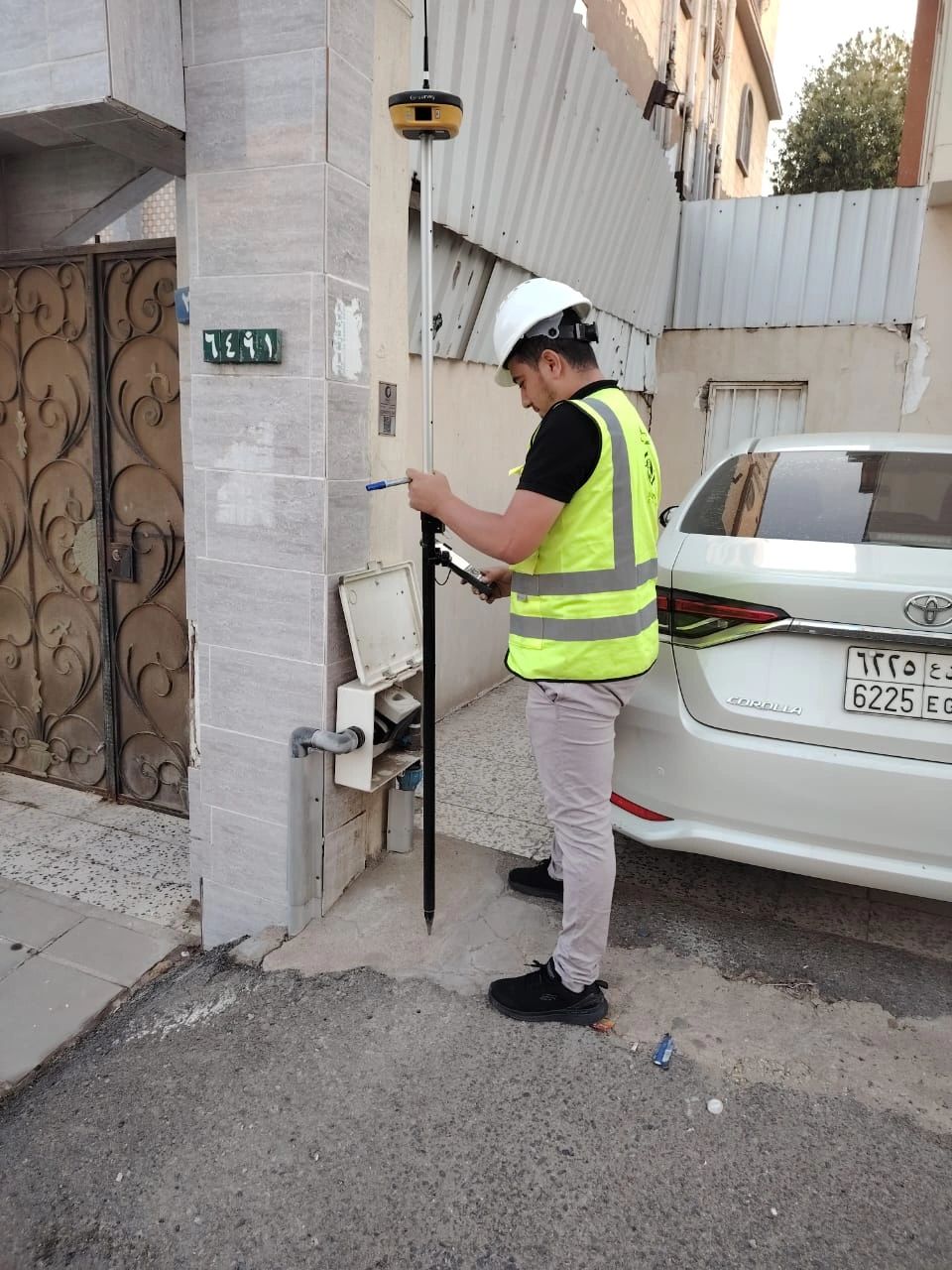
دراسة ورفع جيومكاني – شركة المياه الوطنية (NWC)
العميل: شركة المياه الوطنية – المنطقة الغربية
نطاق العمل:
تنفيذ أعمال الرفع المساحي عالي الدقة لشبكات المياه والصرف الصحي باستخدام أجهزة
DGPS
و
GPS،
وتحويل البيانات الجيومكانية إلى صيغ متوافقة مع نظم المعلومات الجغرافية
(GIS).
النتائج:
- بيانات دقيقة ومحدَّثة لشبكات البنية التحتية.
- إعداد خرائط GIS متكاملة لدعم إدارة الشبكات.
- تعزيز خطط الصيانة والتطوير المستقبلي.
مدة التنفيذ: حوالي 75 يوم عمل
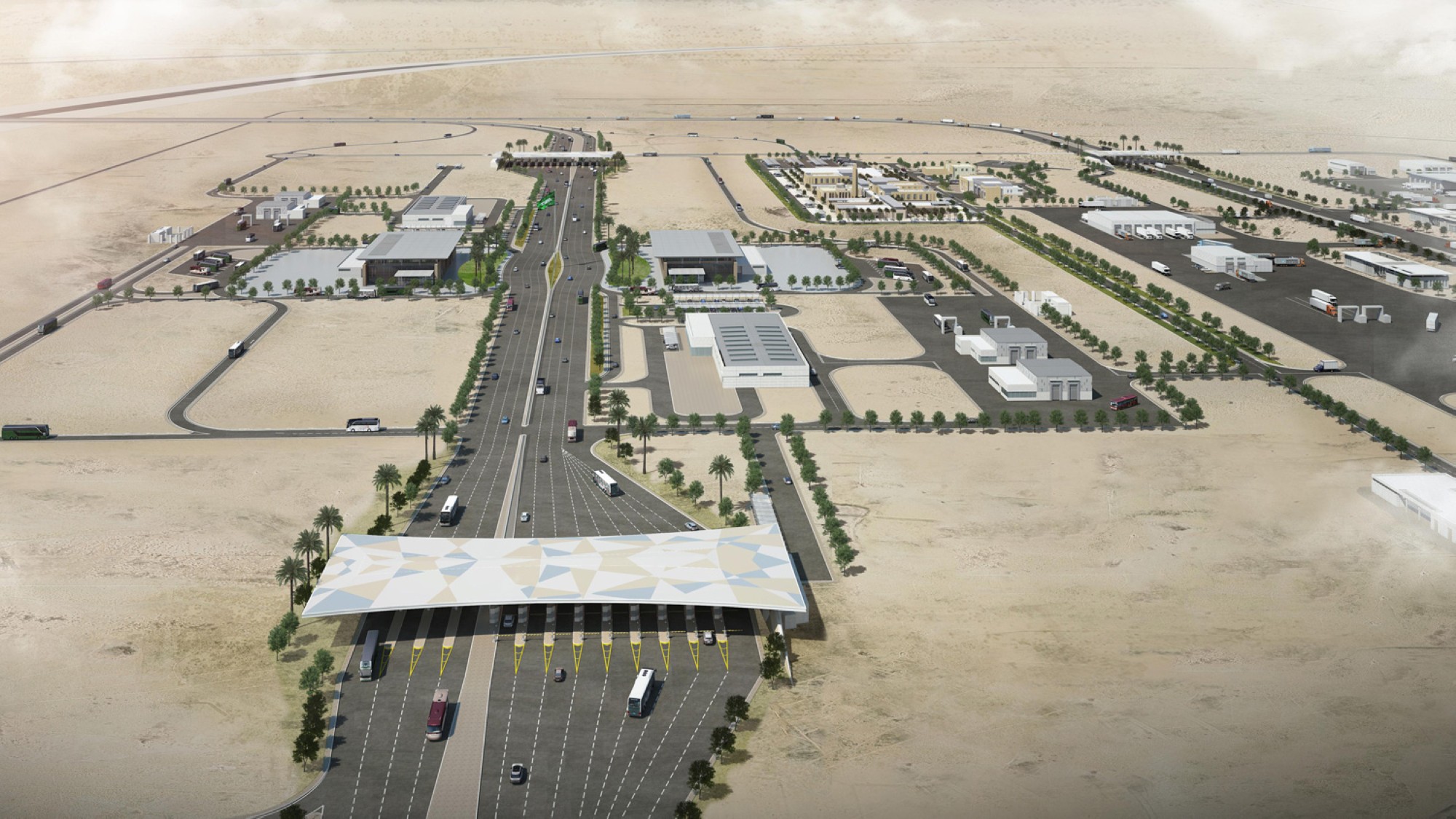
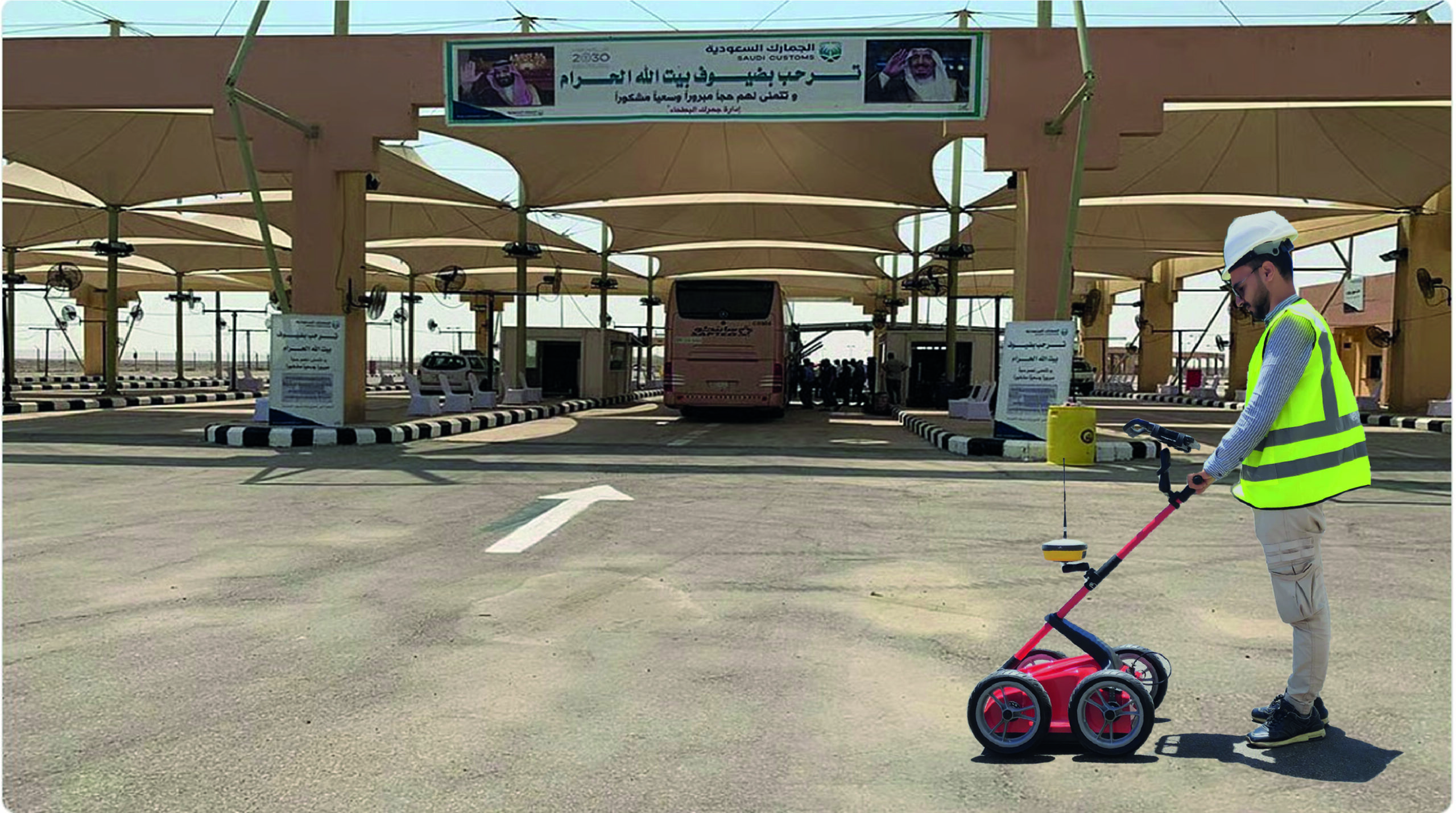
المسح تحت السطحي بالرادار – منفذ البطحاء (GPR) الحدودي
العميل: شركة ديم المحدودة (DEEM Ltd.)
الموقع: منفذ البطحاء الحدودي – المملكة العربية السعودية
نوع الخدمة: كشف المرافق والخدمات الأرضية باستخدام تقنية الرادار المخترق للأرض GPR.
النتائج:
- إعداد خريطة دقيقة لشبكات المرافق والخدمات تحت السطحية.
- دعم عمليات الحفر والتخطيط الميداني بأمان.
- تقليل مخاطر التلف وتحسين إدارة البنية التحتية.
مدة التنفيذ: حوالي 18 يوم عمل.
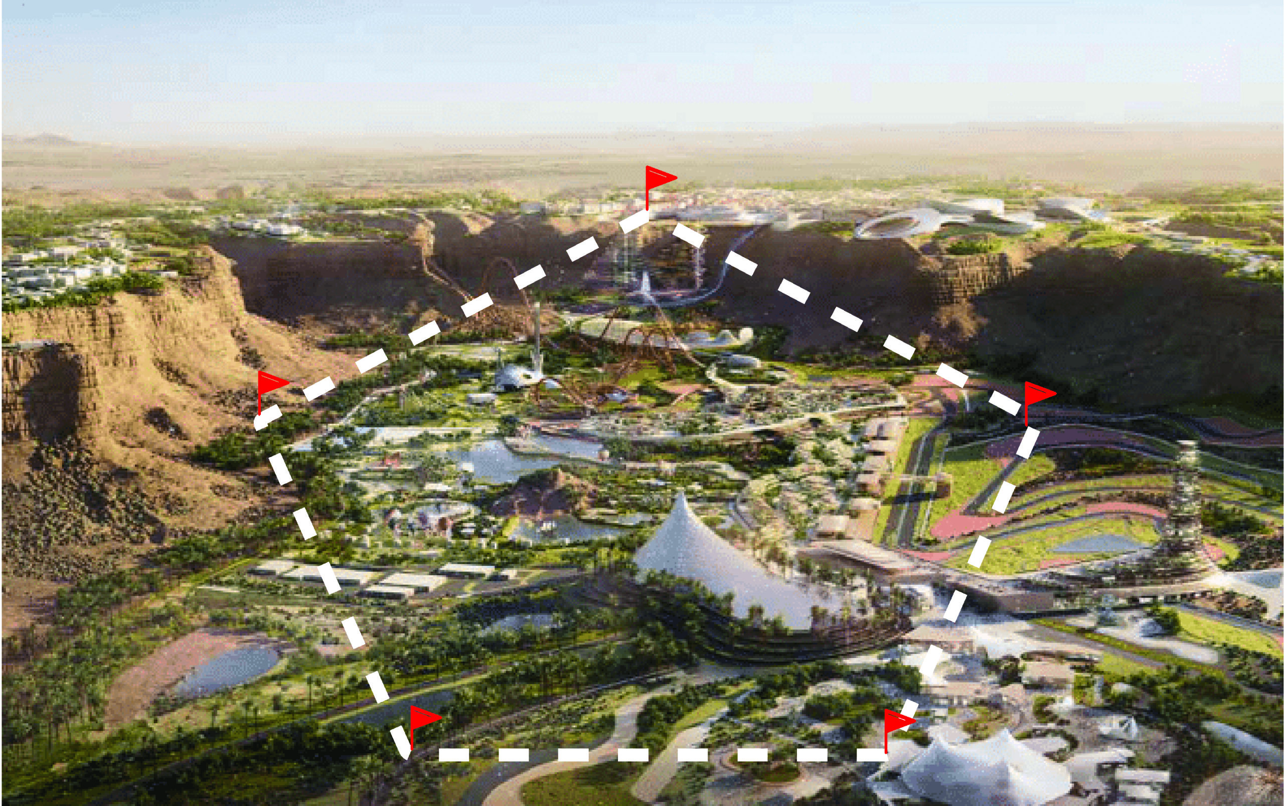
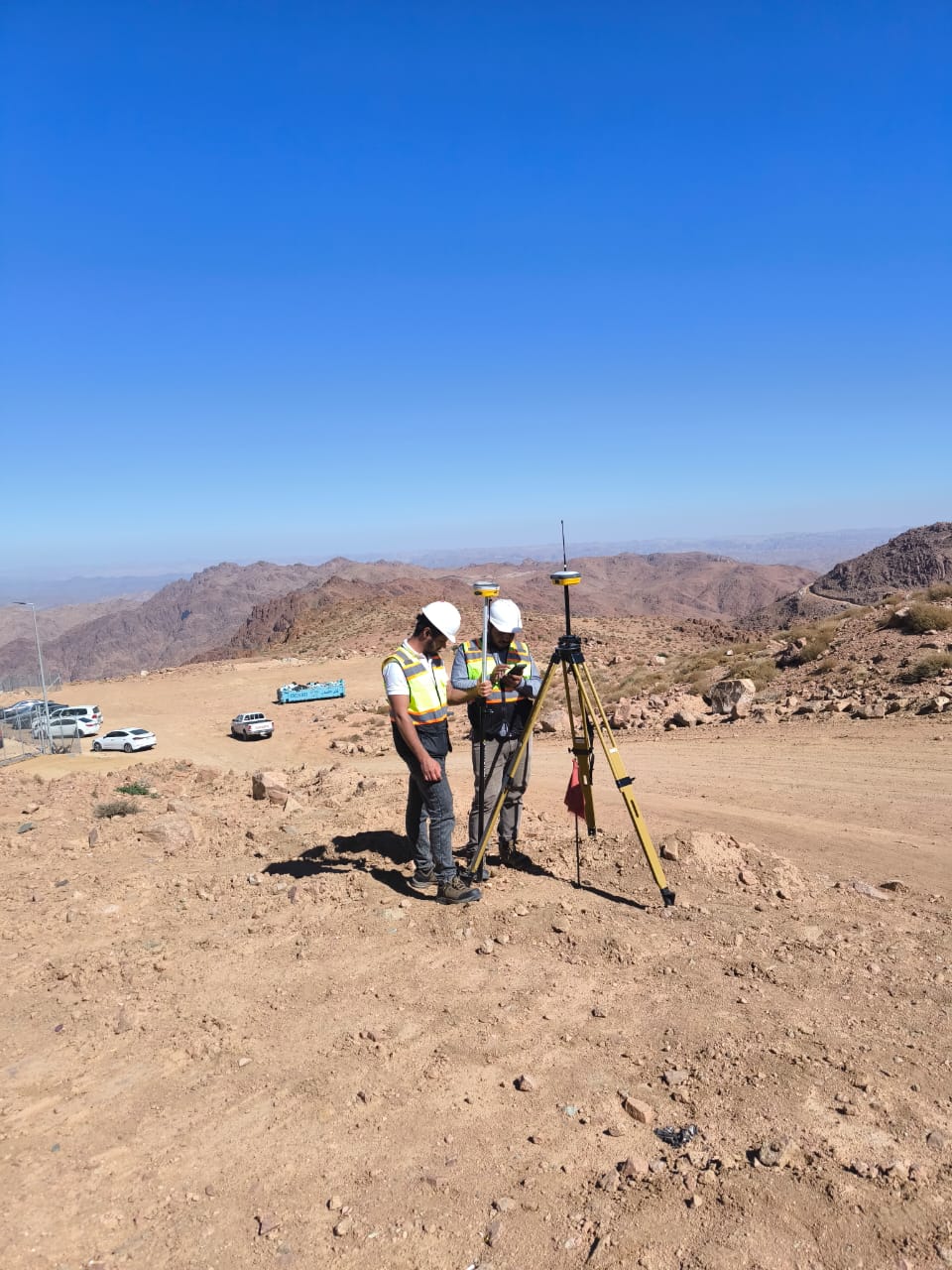
إنشاء ومراقبة نقاط التحكم الثابتة والمضلعات – مشروع القدية، الرياض
نطاق الخدمات:
مراقبة ومعالجة نقاط التحكم الثابتة باستخدام تقنيات GNSS المتقدمة لضمان دقة الإحداثيات وموثوقية البيانات الجيومكانية.
إنشاء شبكة مضلعات عالية الدقة تمت معالجتها باستخدام برنامج Civil 3D لتحقيق أفضل نتائج في أعمال الرفع المساحي والهندسة المدنية.
التحقق الميداني من النقاط بعد المعالجة لضمان مطابقة القيم النهائية للمعايير الفنية المعتمدة في هندسة المساحة، وضمان جودة ودقة القياسات الميدانية.
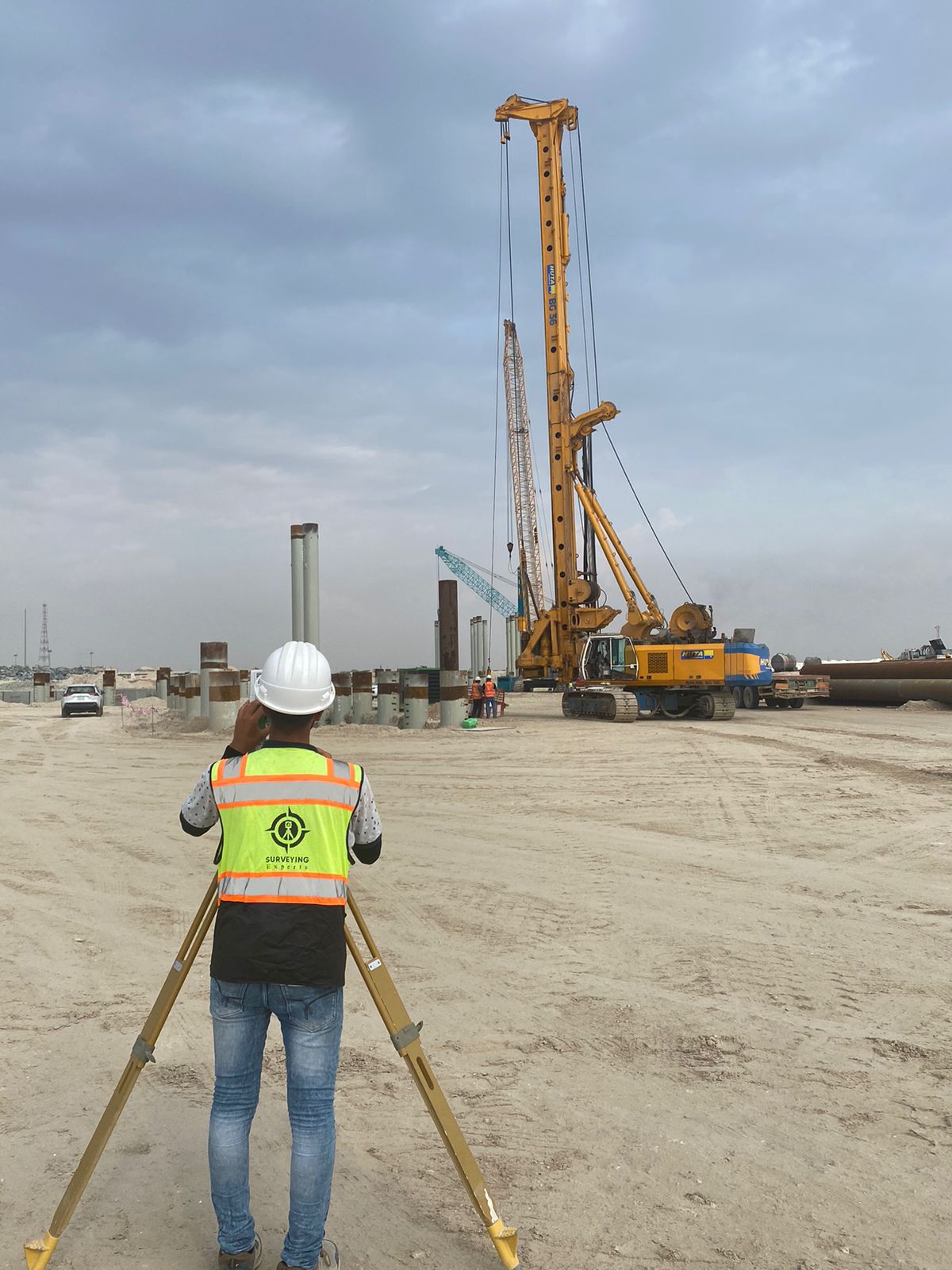
مشروع وسط جدة – أعمال الأساسات والركائز
الموقع: جدة، المملكة العربية السعودية
العميل: شركة MBL
نوع الخدمة: أعمال المسح الهندسي والدعم الفني لعمليات الأساسات والركائز ضمن نطاق المشروع.
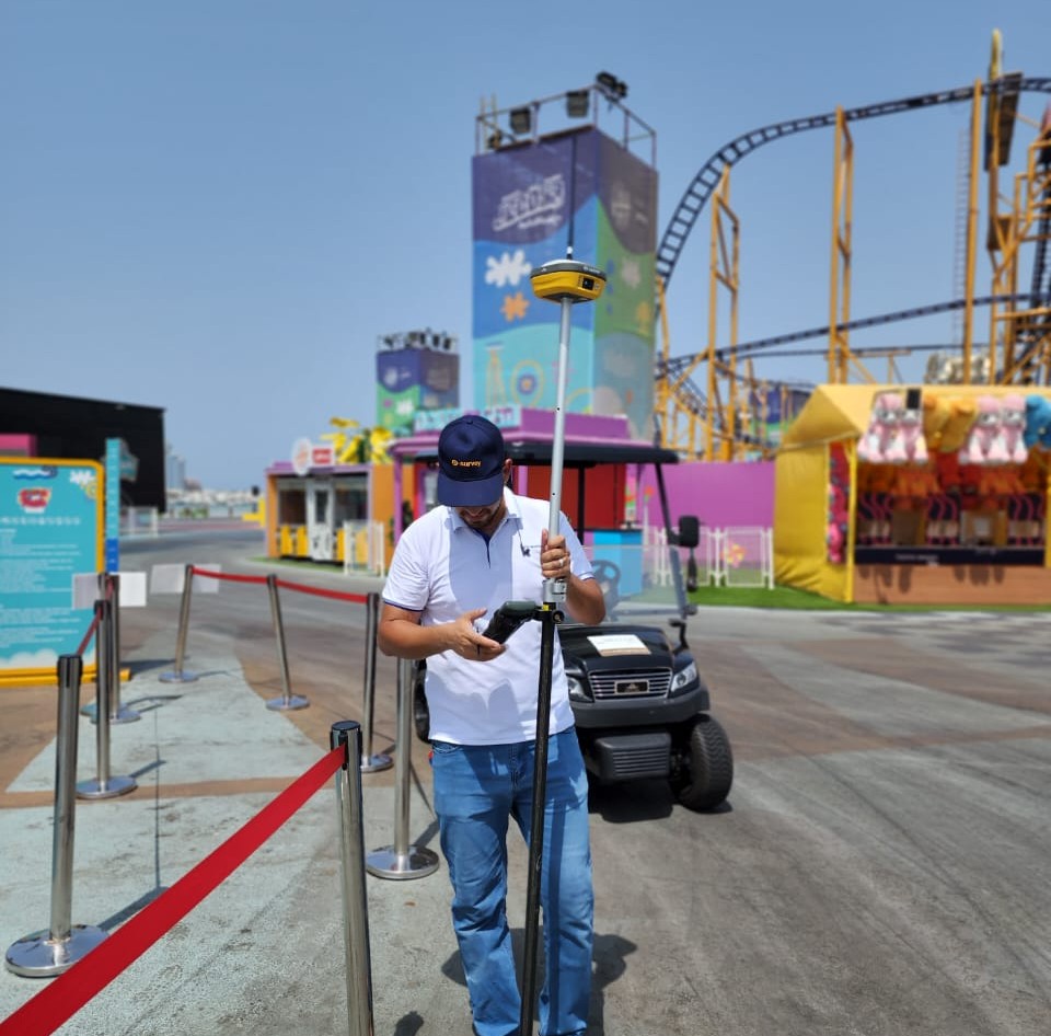
مشروع جدة بير – ساحل البحر الأحمر
العميل: شركة سيلا الرياضية
وصف المشروع:
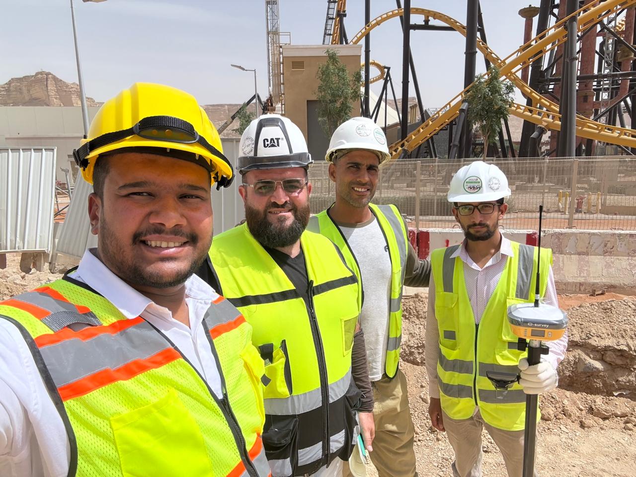
نفذت الشركة المتخصصة مشروع مسح متكامل لمجمع “جدة بير” الترفيهي، باستخدام أجهزة GPS، Total Station، Auto Level وتقنيات Drone Surveying لإنتاج خرائط طبوغرافية دقيقة ونماذج ثلاثية الأبعاد للموقع.
النتائج: تحديد الإحداثيات ومناطق الأمان بدقة. إعداد خرائط تفصيلية تشمل المرافق والمنشآت الترفيهية. دعم عمليات التخطيط والتوسعة المستقبلية للموقع.
محطات كهرباء نيوم – مدينة نيوم
تنفيذ رفع طبوغرافي تفصيلي لمواقع المحطات، مع إنتاج خرائط كنتورية دقيقة بفواصل ارتفاعية مقدارها متر واحد، وربط البيانات بإحداثيات Google Earth لضمان دقة الموقع.

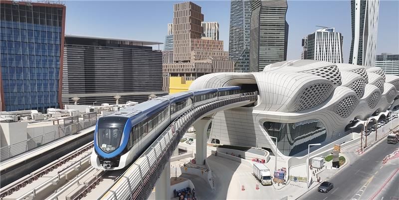
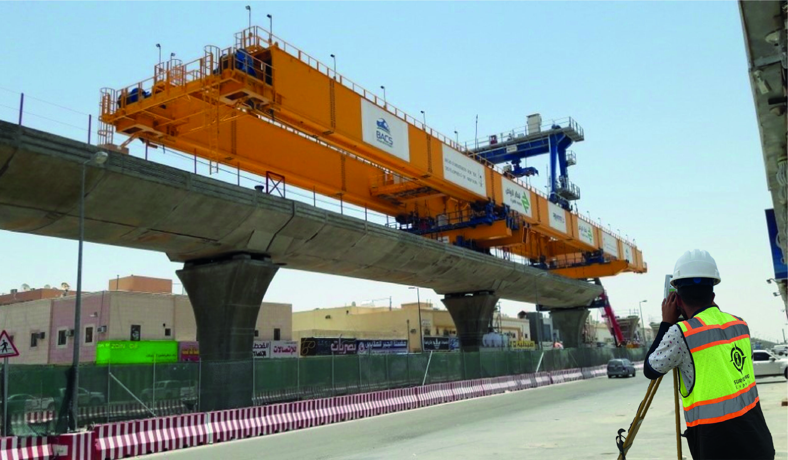
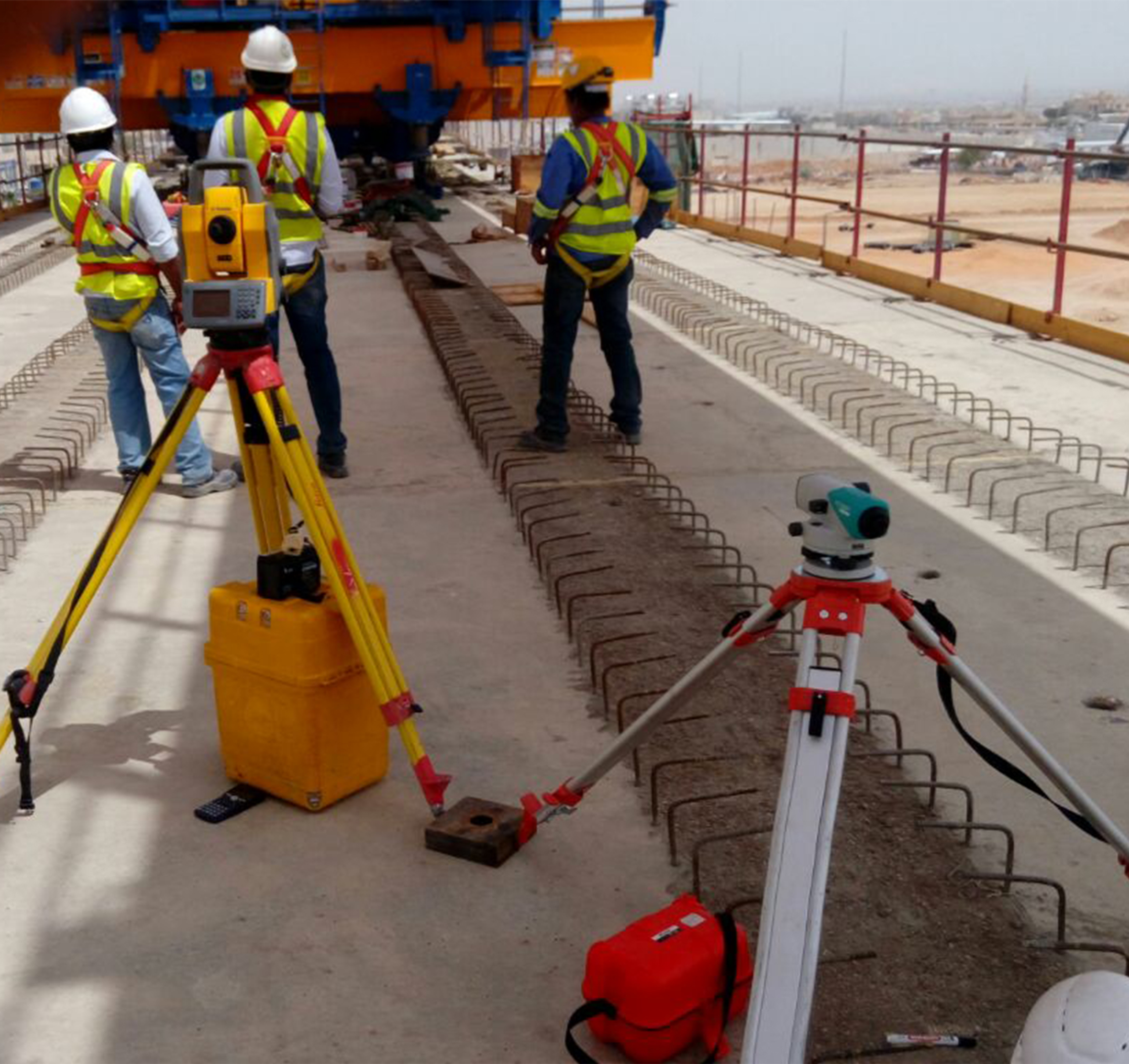
مشروع مترو الرياض – مدينة الرياض
تنفيذ أعمال الرفع الطبوغرافي لمسار المترو قبل وبعد تركيب نظام SPAN، وتحديد الإحداثيات والمناسيب بدقة عالية.
المخرجات:
تسليم الملفات بصيغ KML، CSV، GRD، CAD لدعم التصميم والتحليل الهندسي.
- Featured Projects
Geospatial Survey Study and Support for National Water Company (NWC) Projects – Western Region.
Subsurface Survey Using GPR Technology (Al Batha Border Crossing)
Client:
DEEM Ltd.
Location:
Al Batha Border Crossing – Saudi Arabia
Service Type:
Underground Utility Detection using Ground Penetrating Radar (GPR)
Scope of Work:
Non-invasive radar scanning to detect underground utilities (water, sewage, electricity, fiber optics) using multi-frequency GPR technologies.
The work included high-precision location mapping and soil layer analysis to support infrastructure planning and excavation.
Outcomes:
- Accurate underground utility mapping
- Safe support for excavation and planning activities
- Reduced risk of damage and improved infrastructure management
Duration:
Approximately 18 working days
Technologies Used:
GPR + GPS + Specialized Data Processing Software
Mobile Mapping
We provide mobile mapping services using laser systems and panoramic imaging
mounted on vehicles, allowing the collection of accurate topographic and
engineering data while in motion-without the need to close roads or disrupt
traffic. This makes it an ideal solution for road and urban area projects
Our service scope includes :
– Generating high-density, high-accuracy 3D point clouds
– Comprehensive engineering documentation of road networks, sidewalks, and
surrounding utilities
– Integrating data with GIS systems and Building Information Modeling (BIM)
– Supporting expansion projects, urban planning, and infrastructure development
– Fast execution and operational efficiency without interrupting field operations
Establishment and Monitoring of Static and Traverse Control Points – Qiddiya, Riyadh
Scope of Services:
- Monitoring and processing of static control points using advanced GNSS technologies
- Establishing a high-precision traverse network, processed with Civil 3D software
- Field verification and accuracy inspection of control points after processing
- GPS
- Total Station
- Auto Level
Jeddah Central Project – Foundation and Piling Works
Location:
Jeddah, Saudi Arabia
Client:
MBL
Provided Service:
Engineering surveying and foundational support for piling operations
Jeddah Pier Project – Jeddah, Red Sea Coast
Client:
Sela Sports Company
Project Overview:
Specialized Expertise executed a comprehensive surveying project for the “Jeddah Pier” entertainment complex, located on the Red Sea coast, in two main phases. The project focused on precise surveying of various recreational facilities across the site.
Phase One:
Utilized GPS, Total Station, and Auto Level equipment to carry out topographic surveying and layout work for all project components, including amusement rides, restaurants, and cafés. The scope included accurate boundary marking of all attractions and infrastructure, and the establishment of reference points using the WGS84 coordinate system to ensure precision and consistency across project phases.
Phase Two:
Aerial surveying techniques using drones, in combination with GPS, were employed to perform detailed mapping of existing rides. The phase included safety zone analysis, precise measurement of ride entrances, exits, and control rooms. Vertical sections and CAD execution drawings were produced to support future expansion and ensure technical integration throughout the project.
NEOM Power Stations – NEOM City
Scope of Work:
- Detailed topographic surveying of proposed station locations
- Grid leveling and generation of 1-meter interval contour maps
- Georeferencing site data with Google Earth coordinates
Riyadh Metro Project – Riyadh
Scope of Work:
- Comprehensive topographic surveying of the metro alignment before and after SPAN installation
- Coordinate determination and elevation monitoring
Deliverables submitted in multiple formats: CAD, GRD, CSV, KML
NEOM Power Stations – NEOM City
Scope of Work:
- Detailed topographic surveying of proposed station locations
- Grid leveling and generation of 1-meter interval contour maps
- Georeferencing site data with Google Earth coordinates
Jeddah Pier – Phase I & II (Red Sea Entertainment Zone)
Specialized Expertise executed a comprehensive surveying project for Jeddah Pier, carried out in two phases, covering precise geospatial work for entertainment facilities located on the Red Sea coast.
- Phase One:
GPS, Total Station, and Auto Level instruments were utilized to conduct topographic surveys and staking operations across all elements of the project, including amusement rides, restaurants, and cafés. The scope included accurately defining the boundaries of entertainment zones and establishing geodetic control points using the WGS84 coordinate system to ensure continuity and precision for future phases. - Phase Two:
Advanced drone surveying technology, alongside GPS, was employed to carry out a detailed as-built survey of existing rides, including the analysis of safety buffer zones. The work also included mapping the access and exit points of rides as well as control rooms. Vertical sections and comprehensive CAD drawings were produced to support future expansions and maintain full technical alignment
- Heavy Equipment
- Red Sea coast.
- Location Survey
Qiddiya – Riyadh
Establishment and observation of Static and Traverse points
Equipment: GPS – Total Station – Auto Level
- High-precision GNSS static point observation and processing
- Creation and adjustment of a Traverse network using Civil 3D
- On-site verification and validation of processed geodetic points
City Walk – Jeddah
Equipment: GPS – Total Station – Auto Level
- Full surveying and staking of entertainment facilities
- Boundary marking for rides, gardens, parking, and landscaping areas
- Establishment of global control points
Southern Dunes Resort – Umluj
Client: Red Sea Global
Software: AutoCAD – Civil 3D
- Surveying of infrastructure and buildings
- Supervision of civil works and landscape implementation
- Detailed quantity takeoffs using 3D modeling
- Technical support for steel structures and pipeline routing
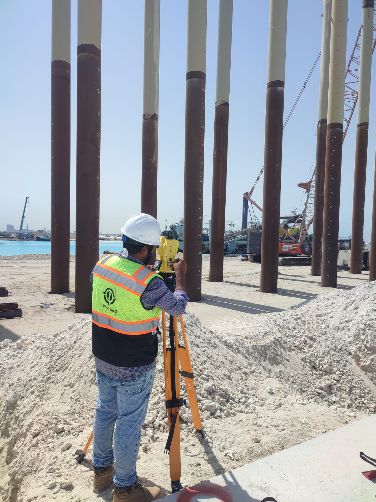
Jeddah Yacht Club – Formula 1 Season
Equipment: GPS – Total Station – Auto Level
- Survey and monitoring for 27 buildings (interior & exterior finishing)
- Hydrographic survey and dredging quantity calculations
- Output formats: CAD – KML – CSV – GRD – Contour Files
Stormwater Drainage Project – Central Jeddah
- Channel route mapping and precise grid leveling
- Monitoring of excavation and backfilling operations
- Slope analysis (longitudinal and cross-sectional)
NEOM Power Stations – NEOM City
- Detailed site surveying for proposed power stations
- Grid leveling and 1-meter contour mapping
- Integration with Google Earth coordinates
Salwa Border Crossing – Qatar Border
Equipment: 3D Scanner – GPS – Total Station
- Comprehensive site survey and creation of reference maps
- 3D modeling using Point Cloud data
- Green area analysis and detailed grid leveling
Al Hamra Corniche – Jeddah
Equipment: 3D Scanner – GPS – Total Station
- Survey of all structures, seating areas, fountains, parking, and greenery
- Production of accurate topographic and contour maps
- Output: CAD – KML – CSV – GRD
Riyadh Metro – Riyadh
- Complete route surveying before and after SPAN installation
- Coordinate determination and elevation control
- Delivery in multiple formats: CAD – GRD – CSV – KML
Jabal Al-Leith Island – Al-Leith
Equipment: GPS – Total Station – Bathymetric Tools
- Full survey of island terrain and surrounding water
- High-resolution contour and grid maps
- 3D topographic modeling of land and sea
Mountain Road Project – Makkah
- Full topographic survey of mountainous terrain
- Terrain analysis and cross-section creation
- Delivery of reference maps: CAD – DEM – GRD
Bank Albilad – Regional HQ – Riyadh
- Precision layout and finishing works: excavation, shuttering, guidewalls
- Daily elevation control and execution monitoring
Al Haditha Border Crossing – Jordan Border
Technologies: 3D Scanning – GIS – AutoCAD
- Detailed as-built surveying and architectural plan generation
- Green area analysis and ground budgeting
Al Haditha Border Crossing – Jordan Border
Technologies: 3D Scanning – GIS – AutoCAD
- Full survey of natural and architectural features
- Creation of Contour and Grid Files
- Support for urban planning applications
KAUST – Thuwal
- Comprehensive irrigation and landscaping network survey
- Production of excavation levels and implementation maps
Aali Jeddah – Jeddah
- 400 buildings – 8,000 housing units
- Traverse network setup – plot layout – elevation calculation for units
Old Jeddah Corniche – Jeddah
- Survey of structures and recreational services
- Output files: KML – CAD – Grid
Wurood City – Jeddah
- Over 4,000 villas – 9 million m²
- Precision staking from excavation to second floor roof
Thuwal Utility Connections – Water Networks
- Complete survey of networks and residential connections
- Project submission in GIS format to local authorities
Taif Schools
- Pre-excavation survey, elevation checks, and building staking
- Production of detailed implementation files
Exhibition Halls Survey – Jeddah / Riyadh
- Full architectural interior and exterior detailing
- Delivery of high-accuracy topographic maps
Al-Ra’idah Housing Project – Jeddah
- Plot design across 2 million m²
- Project boundary surveying and full deliverables
Industrial Incubators – Dammam
- Staking for excavation, footings, columns, fill elevations, and slab levels
- Support for industrial development initiatives
Third Industrial City – Riyadh
- Pre and post-excavation survey, grid leveling, cut-and-fill calculations